Posted By: David Parker Best mapping software ever! GOOGLE EARTH is simply unbelievable - 08/18/05 04:49 AM
Maybe everyone has seen this...I'm often the last to know cool stuff.
If you have not seen Google Earth, go here and download it. Astonishing, beyond compare! Be sure to fly through the Grand Canyon and learn how to fly down your own street or sail your next distance race from 1000 feet up. Be sure to flip switches and read the travel forums. I spend too much time on my computer as it is but now I may NEVER get any sleep. This thing is addictive.
http://www.snapfiles.com/get/googleearth.html Google Earth download Posted By: Mary Re: Best mapping software ever! GOOGLE EARTH is simply unbelievable - 08/18/05 06:03 AM
Thank you for telling us. It is absolutely fantastic! Now I may never sleep again, either.
Posted By: palmwolfe Re: Best mapping software ever! GOOGLE EARTH is simply unbelievable - 08/19/05 03:41 PM
I agree this is real cool, can't stop checking places.
Question, I can tell some of the charts(photo's?) are 1 to 2 years old from the places I'm looking at.
How old or current do you think from the places you look at?
Posted By: Luiz Re: Best mapping software ever! GOOGLE EARTH is simply unbelievable - 08/19/05 03:59 PM
From very recent to more than 10 years. The source (satelite) and age depend on the location you are looking at.
Posted By: Jake Re: Best mapping software ever! GOOGLE EARTH is simply unbelievable - 08/19/05 05:41 PM
My area is from late last summer. I can tell because I can see my Hunter 23 in the driveway (I was restoring it over a 6 week period and it lives at the sailing club).
Posted By: hobiegary Channel Islands National Park - 08/19/05 07:53 PM
Santa Barbara to the Santa Cruz Channel
![[Linked Image]](http://www.catsailor.com/bb_files/55805-Ford%20Point%20on%20Santa%20Rosa%20Island%20%20in%20one%20day.jpg) Ford Point, Santa Rosa Island This topographical overlay will show the terrain better.
Ford Point, Santa Rosa Island This topographical overlay will show the terrain better. There is a slide switch at the bottom of the my places window that will allow you to vary the amount of obscurity vs transparency.
GARY

Posted By: Al Schuster Re: Best mapping software ever! GOOGLE EARTH is s - 08/21/05 05:22 AM
Abslutely amazing! I had heard about it, but this is the first time I looked. It seems like the pics from our area are about 1 year old. I can see my truck at work! Wild.
The lake I sail at is Wabamun Lake, which shows on the map as "White Whale". Moby Dick reference? I'm not sure.
Anyway, thanks for the reminder about the site.
Al
Posted By: wyatt Re: Best mapping software ever! GOOGLE EARTH is s - 08/21/05 11:25 AM
Incredible!
My area must have been early spring. Marinas are all there, but no boats in the slips yet. Just wonderful...
Wyatt

Posted By: David Parker Re: Best mapping software ever! GOOGLE EARTH is s - 08/21/05 01:01 PM
There are so many cool aspects of this software I can't find the bottom. Be sure you use the "tilt view" slider on the right...unbelievalbe! Try turning on the buildings, tilt it over hard, and fly through many cities (try New York) just like Flight Simulator. The interactive input of sites and discussion forums are great, too. People report seeing the weirdest things.
Resolution is VERY inconsistant. It must depend on what the Feds are interested that day and what they want to release. In rural coastal California (marijuana growing capital!) I found one area so clear that I could see a guy standing by an old Ford pickup.
You Key Largo racers, check out Jewfish Creek drawbridge and in Virginia Beach you can read a menu at the Duck Inn at Lynnhaven.
Hey, where Hugh Hefner's place?
Posted By: Timbo Re: Best mapping software ever! GOOGLE EARTH is s - 08/21/05 01:25 PM
I did the download, shut down and restarted my computer, which is new a couple months ago, DSL, Pentium 4, Windows xp 2pack, did the security change they recommened, all I get is a green screen, no pictures of anything. When I go to Map, I get a road map, but no satelite pictures...what am I doing wrong....not a geek so talk slowly and be kind please...Thanks.
Posted By: David Parker Post a photo of your sailing site - 08/21/05 01:59 PM
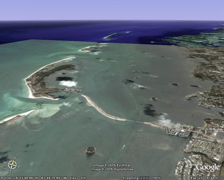
Post a photo of your sailing site taken from Google Earth.
It's hard to decide which view is best but here is one of Dunedin's barrier island chain where I sail. Launch is from the bump on the causeway, then either out the pass to the left into the Gulf of Mexico or stay "inside" and race around the tiny islands.
![[Linked Image]](http://www.catsailor.com/bb_files/55882-GoogleEarth%20Dunedin1.jpg)
Posted By: Jake Re: Best mapping software ever! GOOGLE EARTH is s - 08/21/05 02:09 PM
I did the download, shut down and restarted my computer, which is new a couple months ago, DSL, Pentium 4, Windows xp 2pack, did the security change they recommened, all I get is a green screen, no pictures of anything. When I go to Map, I get a road map, but no satelite pictures...what am I doing wrong....not a geek so talk slowly and be kind please...Thanks.
There are two versions available (both of them should be installed). Go to your start menu, Google Earth, and set it to run by picking one or the other of the DirectX or the OpenGL mode. These are two different graphics modes - one is probably incompatable with your video card (or your software drivers need to be updated).
Posted By: Redtwin Re: Best mapping software ever! GOOGLE EARTH is s - 08/21/05 03:18 PM
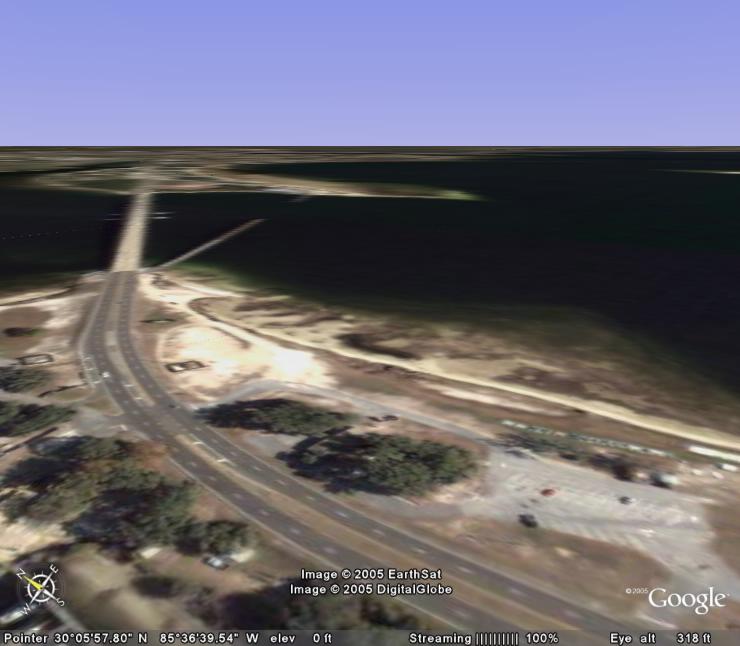
Here is my local haunt. The bridge is the Dupont Bridge in Panama City. You can see the parking lot in the lower right corner and the row of catamarans parked on the beach between the parking lot and the water. Options are to sail around the channel markers on the east side of the bridge, or on light wind days, go under the bridge to west side where the wind blows better. The resolution is kind of crappy, must not be a high priority area. This is actually Tyndall AFB property so not too many marijuana plantations around.
-Rob V.
Panama Ciy
Nacra 5.2
Posted By: Timbo Re: Best mapping software ever! GOOGLE EARTH is s - 08/21/05 03:28 PM
Jake and Dave, I've spent an hour reinstalling, changing settings, all the things you told me, two and three times each, went back to the original site, downloaded it all again, etc.
I get two icons, one round and one square, I changed the way they both open, twice. When I click on the round one, I get the black stars and outer space, with a zooming in baloon pointer when I click on the Colorado River. It zooms in and then goes to an all green screen. No satelite photos, nothing but green.
I get a compass and an arrow, menue bar on the bottom and menue on the left, but just a green screen. I'm sure the reason is either the new Windows XP Home, Service Pack 2, or the super duper McAfee virus protection, something is preventing the loading of the photos, obviously. Yes, I have highspeed.
I'm sure I have messed up my settings now to the point where this computer will have to be thrown in the lake and I'll need to buy a new one! The McAffe stuff is so good at preventing virus' that you can't do anything on the internet! It took me three hours on the phone with Earthlink product support just to get my email to work and I still can't get on one of the websites of my work all of which my 1997, Dialup, Windows 97 did perfectly!! This new stuff is crap! I should have bought a Mac!
Sometimes "new" technology is not "better" technology...
Posted By: SOMA Re: Best mapping software ever! GOOGLE EARTH is s - 08/21/05 10:49 PM
Timbo, With a Mac you would only be able to do what I'm doing, which is reading the thread. It is made, unfortunately, only for Windows based PC's. I HATE THATTT!!!!!!!!!!!!!!!!!!!!!

Posted By: Timbo Re: Best mapping software ever! GOOGLE EARTH is s - 08/21/05 11:37 PM
Well, my New Windows stuff isn't allowing me to see it so what's the difference?
Posted By: Jake Re: Best mapping software ever! GOOGLE EARTH is s - 08/22/05 01:16 AM
Tim, I'm running P4 2.8Ghz, XP Home, McAfee virus protection, with a Radeon X300 series video card (pretty run of the mill). No problems.
Posted By: Brian_Mc Re: Best mapping software ever! GOOGLE EARTH is s - 08/22/05 02:19 AM
Well here's another twist: I'd like to post a picture, and the program works on mymonitor, but if I try to save, send, or print all I get is a black rectangle! Any ideas on that?
Posted By: Tony_F18 Timbo's last resort ;-) - 08/22/05 06:57 AM
Well, my New Windows stuff isn't allowing me to see it so what's the difference?
Download and install the latest version of DirectX (9.0c).
http://www.microsoft.com/windows/directx/default.aspx?url=/windows/directx/downloads/default.htmDo the same for your video drivers, see what make and model it is. (Goto Control Panel->Administrative Tools->Computer Management, expand System Tools->Device manager and see what it says under Display Adapters).
Open your Start Menu->Google Earth and try both the DirectX and OpenGL version.
Let us know if this helps.
Posted By: hobiegary Re: Post a photo of your sailing site - 08/22/05 09:23 PM
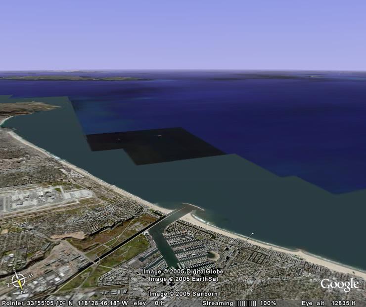
Marina Del Rey. Catalina Island in background.
![[Linked Image]](http://www.catsailor.com/bb_files/55957-Marina%20Del%20Rey%2C%20CA.jpg)
Posted By: hobiegary Ventura - 08/22/05 09:37 PM
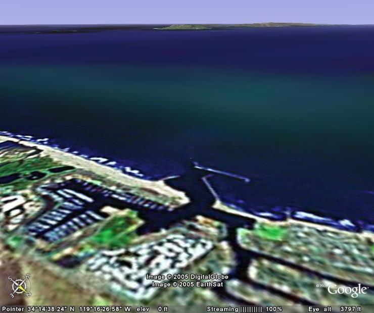
Ventura. Santa Cruz Island in background.
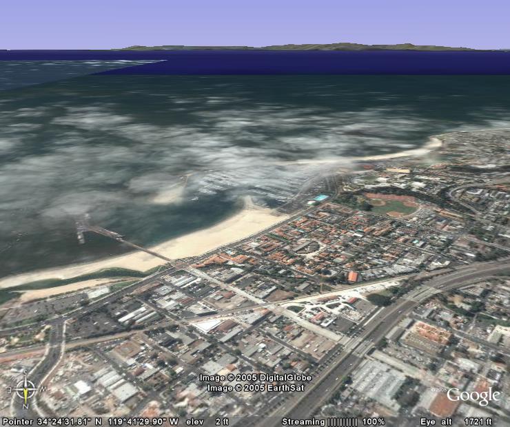
Posted By: hobiegary Santa Barbara - 08/22/05 09:40 PM
Santa Barbara. Santa Cruz Island in the background.
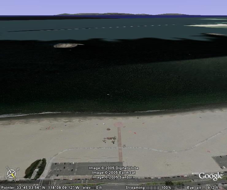
Posted By: hobiegary Claremont Beach - 08/22/05 09:42 PM
Claremont (ave.) Beach. Catalina Island in the background.
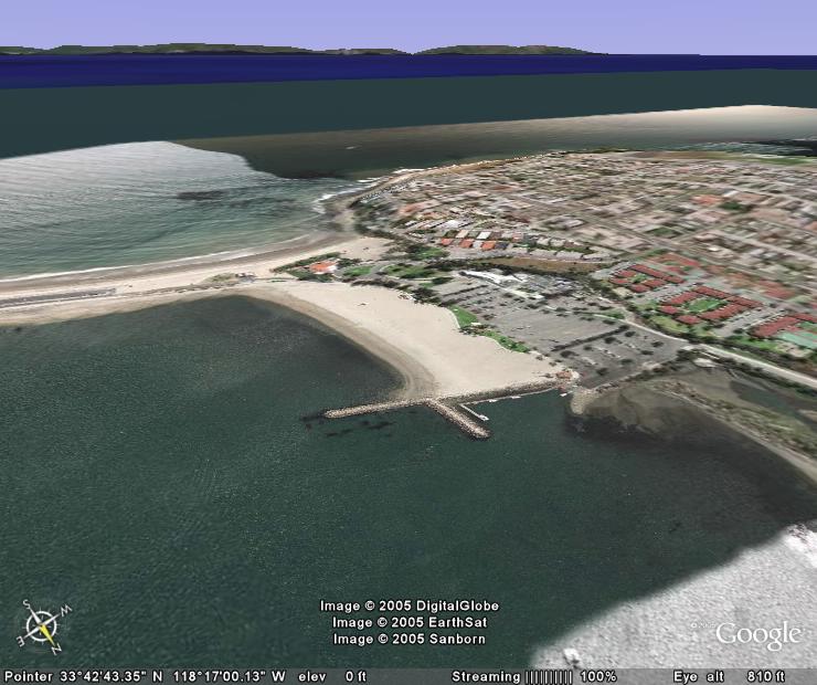
Posted By: hobiegary Cabrillo Beach - 08/22/05 09:43 PM
Cabrillo Beach. Catalina in the background.
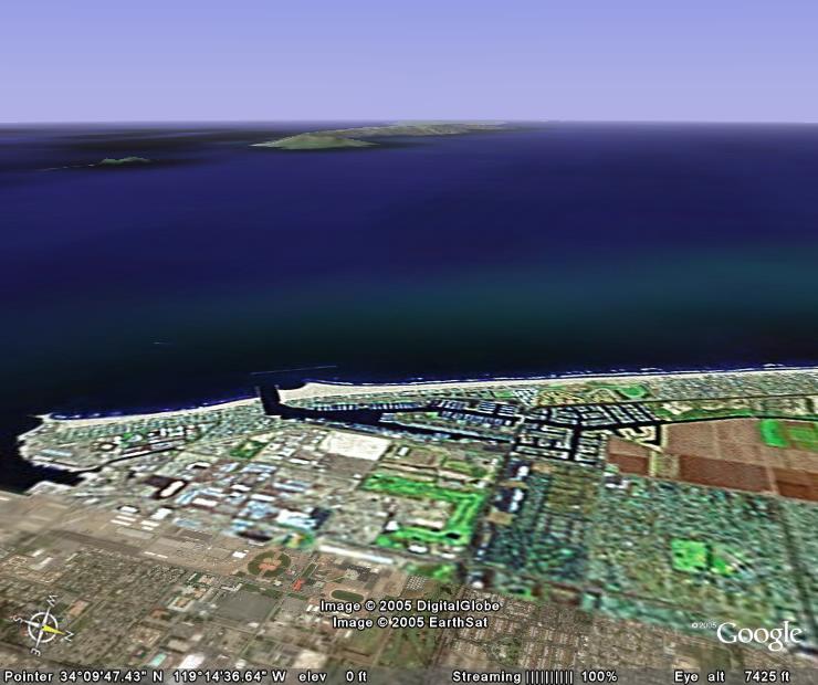
Posted By: hobiegary Channel Islands Harbor, Oxnard. - 08/22/05 09:46 PM
Oxnard. Santa Cruz Island in the background.
Posted By: David Parker Searching the world - 08/22/05 09:58 PM
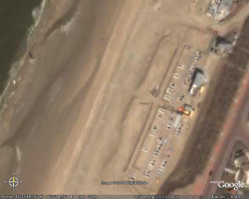
For those who don't frequent the F16 forum, I posted a note there telling of my search of the Netherlands (Netherworld?) to find Wouter's water. Sure enough, just by scanning the beaches I found his sailing club, boats on the beach and all!
Challange....find cats on a beach FAR from your home. For a starting place try Mission Bay in San Diego. I found LOTS just lying around. Early morning and no wind, I guess.
Posted By: bullswan Re: Best mapping software ever! GOOGLE EARTH is simply unbelievable - 08/24/05 05:19 PM
Did you see Fox News this morning.....?
Google Earth led the news that Homeland Security people are worried about the usefulness of Goggle Earth to those who would want to do harm here and abroad. They zeroed in on the White House specifically and you could see the details of the area very clearly. Soooo Google Earth might not exist too much longer.
Posted By: David Parker They changed the photos!!! - 10/14/05 02:50 AM
OK, now this is WEIRD! I've looked over my area in careful detail. Since I started watching Google Earth two months ago the photos of my local beach have changed!! They've been replaced by different photos, yet old ones! In September Jennifer Lindsay impressed me by finding that Google Earth had the Goodyear blimp flying over north Clearwater Beach but now IT"S GONE! My local beach has different boats and cars but from several years ago.
Who's changing the world and why? It's W, I know it!
And how can it be a cloudless morning all over the world at the same time?
Could a person lie awake in bed all night asking themselves endless stupid questions until they finally go crazy and die?

Hey, Lucy! My head's esploding!

Posted By: grob Re: Best mapping software ever! GOOGLE EARTH is simply unbelievable - 10/14/05 06:39 AM
Did you see Fox News this morning.....?
Google Earth led the news that Homeland Security people are worried about the usefulness of Goggle Earth to those who would want to do harm here and abroad. They zeroed in on the White House specifically and you could see the details of the area very clearly. Soooo Google Earth might not exist too much longer.
It could be a good thing for world security, If they kept the pictures up to date there are enough people using google earth to find Bin Laden in no time

Just give a cash prize it could replace the lottery.
Posted By: hobiegary Re: Best mapping software ever! GOOGLE EARTH is s - 10/17/05 05:12 PM
See this post to go to a map to add yourself to the map:
another post ![[Linked Image]](http://www.catsailor.com/bb_files/55805-Ford%20Point%20on%20Santa%20Rosa%20Island%20%20in%20one%20day.jpg)


![[Linked Image]](http://www.catsailor.com/bb_files/55882-GoogleEarth%20Dunedin1.jpg)


![[Linked Image]](http://www.catsailor.com/bb_files/55957-Marina%20Del%20Rey%2C%20CA.jpg)


