Announcements
New Discussions
Previous Thread
Next Thread
Print Thread
Rate Thread
Hop To
Page 4 of 4 1 2 3 4
Re: using gps [Re: erice] #219595
09/14/10 09:45 PM
09/14/10 09:45 PM
Joined: Jan 2009
Posts: 5,525
pgp Offline OP
Carpal Tunnel
pgp  Offline OP
Carpal Tunnel

Joined: Jan 2009
Posts: 5,525
I'll definitely give it a look. Thanks!


Pete Pollard
Blade 702

'When you have a lot of things to do, it's best to get your nap out of the way first.

-- Have You Seen This? --
Re: using gps [Re: pgp] #219626
09/15/10 02:23 PM
09/15/10 02:23 PM
Joined: Dec 2001
Posts: 5,590
Naples, FL
waterbug_wpb Offline
Carpal Tunnel
waterbug_wpb  Offline
Carpal Tunnel

Joined: Dec 2001
Posts: 5,590
Naples, FL
Pete, how would others tell from that if you were pinching? You'd probably have to know the actual TWS/direction, right?


Jay

Re: using gps [Re: waterbug_wpb] #219643
09/15/10 04:40 PM
09/15/10 04:40 PM
Joined: Jan 2009
Posts: 5,525
pgp Offline OP
Carpal Tunnel
pgp  Offline OP
Carpal Tunnel

Joined: Jan 2009
Posts: 5,525
Probably. If you pan out you'll see a head land about half way up Sanibel Island. My specific question would be, with the wind coming out of the W at about 7mph, would that head land cause a header. Watching my speed drop into the 2+ knot range from 5, either I'm missing a shift or allowing the boat to pinch. I think there was an oscillating shift, I'm just not sure if the headland was part of it. Of course, shift or no shift, I might still have been steering badly.

How do you pick up shifts, other than tell tales?

Last edited by pgp; 09/15/10 04:42 PM.

Pete Pollard
Blade 702

'When you have a lot of things to do, it's best to get your nap out of the way first.

Re: using gps [Re: pgp] #219646
09/15/10 07:02 PM
09/15/10 07:02 PM
Joined: Dec 2004
Posts: 23
hobiekite Offline
stranger
hobiekite  Offline
stranger

Joined: Dec 2004
Posts: 23
hi Pete

you wanted to know how to animate tracks and the put them up on youtupe

1. i get the tracks of my GPS with "g7towin" and save it as a .gpx file.

2. open the track with "GpsarPro" (i paid for it, it's that good)and fix the track points that are off the chart (i did not go 50kts ). it also gives all the speed results like best 10sec, 500m.... than i resave the track.

3. load the track into "TopFusion" where you can animate the track with a map like this www.youtube.com/watch?v=IlUtFU321aA

4. that's the tricky part to get a video from the animation.
i use "CamStudio.org" to capture the animation as a video the software is not great but it works.

hope the helps

you can always goto "connect.garmin.com" and upload your tracks. they have animation and maps to. http://connect.garmin.com/activity/42612803


nacra 5.8 h16 new york
Re: using gps [Re: erice] #219648
09/15/10 07:36 PM
09/15/10 07:36 PM

M
MN3
Unregistered
MN3
Unregistered
M


Originally Posted by erice
i once spent a few hours and made a video for youtube

http://www.youtube.com/watch?v=BNAsxV1ltMU

now i spend a few minutes uploading to mapmytracks

and let their software do all the work

http://www.mapmytracks.com/erie

http://www.mapmytracks.com/explore/track/44409


i knew you made a video or 2 but i didn't see that software.. that is really very cool.

how does it know the wind direction? does it calculate that from your path, or do you input that value?

Re: using gps [Re: ] #219653
09/15/10 08:31 PM
09/15/10 08:31 PM
Joined: Sep 2007
Posts: 757
japan
erice Offline
old hand
erice  Offline
old hand

Joined: Sep 2007
Posts: 757
japan
GPSAR, gps action replay, even the old free version Gpsar333, is a very small but sailing specific bit of software made a few years ago by a french windsurfer interested in speed runs

it can do a lot of fun things, like make polars, set different colors for different speeds, give averages of 500mtrs etc.

the map part takes a bit of mucking around though

it has some wind direction finding abilities that presumably work well if the wind blows consistently

however it doesn't work too well on small mountain lakes where the wind channels down valleys and around islands etc.

GPSAR is what i use to analyse my sailing on my computer

http://gpsactionreplay.free.fr/

the wind direction note on the youtube video was a youtube annotation that i added to help make sense of the sailing for non-sailors

but to share animated tracks it is much easier to use internet based animators like mapmytracks

but mapmytracks is not sailing specific and so has less sailing functionality


Last edited by erice; 09/15/10 08:34 PM.

eric e
1982 nacra 5.2 - 2158
2009 weta tri - 294
Re: using gps [Re: erice] #219664
09/16/10 02:41 AM
09/16/10 02:41 AM
Joined: Jan 2009
Posts: 5,525
pgp Offline OP
Carpal Tunnel
pgp  Offline OP
Carpal Tunnel

Joined: Jan 2009
Posts: 5,525


Pete Pollard
Blade 702

'When you have a lot of things to do, it's best to get your nap out of the way first.

Re: using gps [Re: pgp] #220469
09/28/10 07:33 AM
09/28/10 07:33 AM
Joined: Jan 2008
Posts: 3,655
Portland, Maine
T
ThunderMuffin Offline
Carpal Tunnel
ThunderMuffin  Offline
Carpal Tunnel
T

Joined: Jan 2008
Posts: 3,655
Portland, Maine

Re: using gps [Re: ThunderMuffin] #220474
09/28/10 08:19 AM
09/28/10 08:19 AM
Joined: Jan 2009
Posts: 5,525
pgp Offline OP
Carpal Tunnel
pgp  Offline OP
Carpal Tunnel

Joined: Jan 2009
Posts: 5,525
Far out! Thanks.


Pete Pollard
Blade 702

'When you have a lot of things to do, it's best to get your nap out of the way first.

Re: using gps [Re: pgp] #221797
10/17/10 01:46 PM
10/17/10 01:46 PM
Joined: Jan 2009
Posts: 5,525
pgp Offline OP
Carpal Tunnel
pgp  Offline OP
Carpal Tunnel

Joined: Jan 2009
Posts: 5,525
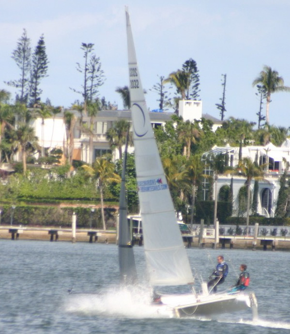
Arie and I launched from the Sanibel causeway yesterday and went out to watch Summerset. http://www.cmcs-sail.org/

My truck and trailer were still there when we got back, we didn't get a ticket, get shot or arrested. So I guess for the moment the Sanibel causeway is accessible for cats.

http://connect.garmin.com/player/53372119

This is the easiest way, by far, that I have found to post gps tracks.

Last edited by pgp; 10/17/10 02:16 PM.

Pete Pollard
Blade 702

'When you have a lot of things to do, it's best to get your nap out of the way first.

Re: using gps [Re: pgp] #221818
10/17/10 09:39 PM
10/17/10 09:39 PM
Joined: Aug 2007
Posts: 190
lesburn1 Offline
member
lesburn1  Offline
member

Joined: Aug 2007
Posts: 190
this site work well, as well.

http://www.mapmytracks.com/


lesburn1.blogspot.com

A-Cat USA 49
18Sq 49

member- Royal Society for Making Cool Stuff
Re: using gps [Re: pgp] #221881
10/18/10 11:30 AM
10/18/10 11:30 AM
Joined: Nov 2005
Posts: 246
Kiel, Germany
Baltic Offline
enthusiast
Baltic  Offline
enthusiast

Joined: Nov 2005
Posts: 246
Kiel, Germany
Originally Posted by pgp
I was going to mount it on the boom. Maybe not.


Do so! I have mine always on the boom and never had any problems. However, if you just want to record data and don't need direct view on the display (speedometer, etc.) you can store it in the pocket of your trampoline - if it has a zipper. The unit does receive satellite signals in there, too.


F18: C2 / A-Cat: Minelli
Re: using gps [Re: Baltic] #221884
10/18/10 11:42 AM
10/18/10 11:42 AM
Joined: Jan 2009
Posts: 5,525
pgp Offline OP
Carpal Tunnel
pgp  Offline OP
Carpal Tunnel

Joined: Jan 2009
Posts: 5,525
Actually, this last track was recorded inside the hull. I put it and some valuables in a waterproof bag and stuck it in the port.

I also like this summary report. No idea what the elevation is all about.

Attached Files
summary.JPG (70 downloads)
Last edited by pgp; 10/18/10 11:46 AM.

Pete Pollard
Blade 702

'When you have a lot of things to do, it's best to get your nap out of the way first.

Re: using gps [Re: pgp] #221903
10/18/10 01:42 PM
10/18/10 01:42 PM
Joined: Nov 2007
Posts: 164
fort Myers, FL
arievd Offline
member
arievd  Offline
member

Joined: Nov 2007
Posts: 164
fort Myers, FL
Cool! Guess it did work...and you must be better at technology than you give yourself credit for wink


Arie
Hobie 16 111812
Re: using gps [Re: pgp] #221906
10/18/10 01:46 PM
10/18/10 01:46 PM
Joined: Nov 2007
Posts: 164
fort Myers, FL
arievd Offline
member
arievd  Offline
member

Joined: Nov 2007
Posts: 164
fort Myers, FL
Originally Posted by pgp
No idea what the elevation is all about.


Since this is measured by barometric pressure changes, it was probably the hull heating up/cooling (since the GPS was inside)


Arie
Hobie 16 111812
Re: using gps [Re: arievd] #221950
10/18/10 06:23 PM
10/18/10 06:23 PM
Joined: Jul 2001
Posts: 2,844
42.904444 N; 88.008586 W
Todd_Sails Offline
Carpal Tunnel
Todd_Sails  Offline
Carpal Tunnel

Joined: Jul 2001
Posts: 2,844
42.904444 N; 88.008586 W
Elevation, on a lake?

Reminds me of the Texas Aggie Waterskier who got a new waterski for his birthday. He didn't use it for over two years though.

Why not you ask?

Because it took him that long to find a lake
with a downhill slope!


F-18 Infusion
#626- SOLD it!

'Long Live the Legend of Chris Kyle'
Re: using gps [Re: arievd] #221965
10/18/10 08:33 PM
10/18/10 08:33 PM
Joined: Jun 2001
Posts: 12,310
South Carolina
Jake Offline
Carpal Tunnel
Jake  Offline
Carpal Tunnel

Joined: Jun 2001
Posts: 12,310
South Carolina
Originally Posted by arievd
Originally Posted by pgp
No idea what the elevation is all about.


Since this is measured by barometric pressure changes, it was probably the hull heating up/cooling (since the GPS was inside)


if you have a high end GPS unit it may have a true barometric pressure sensor...but chances are it's sensing it's position relative to the satellites to establish a 3D position (lat, long, elevation). Calculating elevation by GPS signal is less precise than latitude and longitude and the 11 foot difference is likely just the amount of error in the elevation calculation and/or a periodic weak signal.


Jake Kohl
Re: using gps [Re: Jake] #221975
10/18/10 10:34 PM
10/18/10 10:34 PM
Joined: Dec 2003
Posts: 1,066
Wellington, FL-Singer Island, ...
cyberspeed Offline
old hand
cyberspeed  Offline
old hand

Joined: Dec 2003
Posts: 1,066
Wellington, FL-Singer Island, ...
Or maybe you were flying a hull hooked in a harness wearing the GPS around your neck on a Supercat 20, F20 carbon, M20 or tornado...

Factor in the 8-10 foot ocean swells and the 11 feet seems a bit on the low side.


craig van eaton
Supercat 20
TEAM CYBERSPEED
www.TeamCyberspeed.com
Endurance Series
www.SailSeries.com
Page 4 of 4 1 2 3 4

Moderated by  Damon Linkous 

Search

Who's Online Now
0 registered members (), 409 guests, and 98 spiders.
Key: Admin, Global Mod, Mod
Newest Members
Darryl, zorro, CraigJ, PaulEddo2, AUS180
8150 Registered Users
Top Posters(30 Days)
Forum Statistics
Forums26
Topics22,404
Posts267,055
Members8,150
Most Online2,167
Dec 19th, 2022
--Advertisement--
Powered by UBB.threads™ PHP Forum Software 7.7.1