You guys are on the right track for a most excellent adventure.
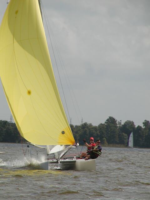
Beach and boat camping on a beachcat is a blast and very "do-able".
We've taken beachcats into open ocean on our way to beach camp on Catalina Isalnd, 30+ miles off shore from southern california in all kinds of conditions (i.e., 30+ winds and very bumpy seas).
Here are some things we learned that might be interesting for you to consider, of course modified for your own situation.
Keep, use, modify or toss as you see fit.
Keep us posted on how you guys are coming and what happens along the way and a report of your trip.
Tom
Our tips and tricks fall into several catagories, such as the one we put together for "Sailing to Catalina on a Catamaran" and includes the folloiwng catagories and detials that follow this outline:
Contact Information of those going and destinations:
Required Gear to Bring on Boat:
Recommended Additional Gear to Bring:
Camping Gear:
General Information:
Activities - There are lots of things to do on Catalina:
Driving Directions:
GPS Coordinates:
Sailing Information:
Sailing Plan:
Return Sailing Plan:
Tide Information:
CONMTACT INFORMATION
• (Insert your own group's infomraiton here)
• Two Harbors Info & Camping: 800-785-8425 & 310-510-0303
• Two Harbors Harbor Dept: VHF Chnl #9
• Two Harbors Shoreboats: VHF Chnl #9
• Catalina Express ferry: 800-481-3470 (reservations required)
• U.S. Coast Guard: 310-980-4444 & VHF Chnl #16
Required Gear to Bring on Boat:
Start by putting all you wish to take with you in one big pile. Then divide the piles into three piles.
The first pile is what you have to have to be legal, sustain life and limb and what you desperately need in an emergency. The second pile is what would make the trip a bit comfy and the third is what would make the trip very comfy. Then take only the first pile with you and be extremely wise and judicious with the second pile and leave the third pile at home or in the tow vehicle.
Beach camping on a beachcat is like minimalist backpacking so leave the cast iron Dutch oven (figuratively speaking), etc. because this kind of stuff takes up valuable space and adds weight and will get in the way.
With that said here are some things to think about:
• Waterproof VHF marine radio in a waterproof radio bag. Standard HX350S Submersible is one of the best choices for catamarans. Protect the radio from direct hits by ocean waves. Keep it inside a duffel bag or other container when not in use. Make sure your battery is fully charged before leaving! Don't wear down your battery by using the radio unless necessary! Most radio failures are battery failures. Waterproof bags aren't perfect. They often leak a tablespoon or two of water. In order to prevent this from corroding your radio (esp. the battery charging contacts), always remove the radio from the bag after sailing and rinse it in fresh water.
• PDF of appropriate size, with attached whistle, for each person. These must be worn at all times.
• One wetsuit per person, of appropriate size. It is recommended to wear the wetsuit all of the time from the beginning of the trip to avoid fatigue from cold, wind, etc.
• Three meteor flares and three hand-held flares
• A paddle (daggerboards do NOT count!)
• Minimum 1 liter of water per person (more recommended).
• Waterproof flashlight
• Compass
• Map of Catalina, San Pedro Channel, and Long Beach/LA Harbor. If you laminate this in clear plastic shelf lining material (about $3/roll), it will be waterproof and tearproof. Bring 2 copies in case you lose one.
• Rigging and trapeze wires in good shape. Any rusty wires or wires with broken strands must be replaced before the trip. Also check the trapeze wires, hooks, adjusters, and lines.
• A righting line sufficient to right the boat unassisted.
• A 50 foot or longer tow line, 1/4 inch minimum. This line is also used to secure the boats on beach at Catalina when unattended.
• Give your boat a shakedown sail BEFORE the day of the trip! Check the sails, rigging, righting line, etc. Practice tacking, gybing, trapezing, and otherwise sailing your boat with all crew and gear aboard. Practice a capsize and righting to make sure you know where everything is, that it is working properly, and that your gear won't cause a problem. Also, practice furling your jib around the forestay in case this is needed because of high winds. Make sure the jib can be tied securely and won't come undone in the wind, even after 3 hours of flogging.
Recommended Additional Gear to Bring:
• Spray-suit (semi-dry suit) or spray-top to wear over your wetsuit. These really help to keep you warm by cutting down the evaporative cooling of water from your wetsuit.
• Sunscreen, hats, sunglasses. You should also wear retaining devices for your glasses and hat. I use croakies on my glasses, and I use an old batten tie from my hat to my shirt (attach with a safety pin).
• Swim goggles - These may be handy to keep spray out of your eyes if it is very windy/choppy
• Trapeze harnesses for all on board. If the wind is very strong, the boat can be much easier to control when one or two crew trapeze.
• Spare pins, clevis pins (ring ding's), and shackles for your boat.
• Towing insurance in case of breakage - SeaTow, BOAT/US, and Vessel Assist offer cheap insurance (e.g. about $70/year for unlimited towing). If anything breaks halfway to Catalina and you need a tow, it could easily cost you $500-$1000 depending on distance, weather conditions, etc.
• Marine insurance for your boat - If bad weather forces you to abandon your boat, if high waves destroy your boat on the rocks, or if some other calamity strikes, you will wish you had this. It is very inexpensive (about $10/month for full coverage). It will also protect you if you collide with another boat and must pay repair costs or personal injury damages.
Camping Gear:
• Large Dry Bag - These are large enough to hold a sleeping bag and clothes, etc for 1 person. Get this early! Suppliers are West Marine, REI, A16, and Cascade Outfitters (go to
http://www.cascadeoutfitters.com/riverhome/bagsm.html). West Marine usually has 2-3 in stock, and can get more from their warehouse in 2-3 days. But, if 15 people show up just two days before the trip, there won’t be time to order enough drybags and there might be a problem!
• Sleeping Bag - We are going in the summertime in Southern California, so it won’t be too cold. However, remember that we are outdoors and it could get chilly at night. Also, there is usually a lot of dew that falls at night, and if you are sleeping in you bag under the sky (this is what I do), it will get a little damp on the outside. You may not want to bring an expensive down bag, however, as there is always the possibility that it could get wet while sailing on the boats! An inexpensive to medium cost synthetic sleeping bag is usually a good choice.
• Sleeping Pad - If you want to sleep on the ground, bring an Ensolite pad or similar to keep your sleeping bag off of the dirt and rocks. This will also keep you warmer. I prefer to sleep on the trampoline, since it is like a giant hammock. It is much softer than sleeping on the ground, and also significantly warmer, since your body heat isn’t going directly into the cold ground.
• Tent - I don’t use one, but if you want to you can bring a tent. It can be used either in the campground (advance reservations are required for the campground) or on the beach next to your boat. If it is one of the self-supporting kinds (with a built-in frame), you could also set it on the trampoline, to keep the hammock effect but still have an enclosed sleeping space. BE careful to put a blue type tarp over the tent that extends past the edges of the trampoline. Otherwise, don’t be surprised when the tent run off follows the tent’s sides to the tramp and the tent and content becomes wet due to the wicking effect of the rain coming up through the tent’s bottom, as it drips off right under the lowest point.
• Tarp - If you want to sleep on the ground, you may want a tarp to place under your sleeping bag & pad. You could also use a tarp & some spare lines to make a tent on the boat using the boom.
• Toiletries - toothbrush, toothpaste, floss, hairbrush or comb, etc.
• Clothes - General suggestions are:
1 pair jeans
1 swimsuit
2-3 t-shirts
1 sweatshirt
1 rain slicker
1 hat (for sailing or general usage)
1 pair shoes/sandals - If these can get wet, they are easier to carry on the boat since you don’t need to fit them in a drybag. If you want to do a lot of hiking, choose appropriate shoes to bring along.
1 set of clothes kept in the tow vehicle so you and the clothes aren’t “stinky” from a week of beach camping and ou can use them and a fresh shower to get you back into the house
• Spare trash bags + duct tape - These may come in handy for emergency waterproofing of extra gear.
• A large nylon duffel bag - I place my drybags inside a duffel bag when carrying it on the boat. There are several purposes for this:
1. The duffel protects the plastic drybag from puncture.
2. The duffel has extra pockets for stuff that doesn’t need to stay dry. This also includes fast-access items like water, snacks, radio/GPS, etc.
3. The duffel deflects the initial brunt of waves from the drybag. Full force waves may force their way inside the seal of the drybag. The duffel cuts at least 90% of the wave’s force before it hits the drybag to reduce this problem. Another tip: face the drybag seal toward the rear of the boat (inside of the duffel) to further reduce wave-induced leakage.
4. The duffel is easier to attach to the boat. Duffels usually have several strong handles, which can be tied with lines. Use 2 lines to attach the duffel to your boat. The primary line is about 8’ long, and is tied from the duffel to the mast. It should be very strong and tied securely. The spare line can be coiled and stuffed somewhere out of the way. The second "working" line is only 3’ long, and is usually tied to one end of the duffel. The other end can be used to secure the duffel to the windward side of the boat in a convenient position, or to the mast when tacking/gybing a lot. In the event of a capsize, you don’t want 50 lbs. of gear attached to the trampoline or the mast, where it would work against the weight of the crew, perhaps making the boat unrightable. To avoid this problem, if you capsize, just untie the short working line and let the duffel float in the water. It will still be secured to the boat by the longer, primary line. After righting, pull the floating duffel from the water and back onto the boat.
General Information:
• Camping Fees - It is $12/person/night to camp at Two Harbors. Kids are $6/person/night. Please bring cash with you, so we can pay upon arrival at Two Harbors.
• Restrooms & Showers - There are portable toilets at the campsite. At the central area near the pier, there are public restrooms available. This location also has free hot showers adjacent to the restrooms.
• There is running water available at the campsite, as well at the pier.
• Trash Recycle - Catalina recycles all waste. You will notice that garbage cans always come in pairs, with one for recyclable materials (glass, aluminum, etc). PLEASE put your recyclables in the appropriate container, as the island has very limited landfill space!
• ATM - There is an ATM located at the rear of the Harbor Reef restaurant building. All locations also accept credit cards.
• Food - Doug’s Harbor Reef restaurant serves dinner each day, and breakfast on weekends (make dinner reservations early in the day to assure a table - check in the cafe for the reservations book). There is an adjacent snack grill open for breakfast & lunch daily. The outdoor patio is the center of Two Harbors social life, where people can sit & talk over drinks at any time of the day. They usually have music and dancing on weekend evenings.
• General Store - The Two Harbors General Store has almost anything you could want, including food, drinks, fishing/boating supplies, clothing and souvenirs.
• Animals - You may encounter wild buffalo or wild pigs while on the island. They are not dangerous, but it would not be wise to provoke any wild animal. You can minimize any problems by keeping any food items tightly packed away and disposing of garbage properly.
• Other Catalina Information - Go to the Catalina website at
http://www.catalina.com. They have a wealth of information, maps, tips, and contact info.
Activities - There are lots of things to do on Catalina:
• Hiking - A fun and easy hike is to walk across the isthmus to Catalina Harbor (the southwest half of Two Harbors). This is the only natural harbor between San Diego and San Francisco offering all-weather protection for boats. This is a great spot for a picnic or sightseeing. For longer hikes, try going west along the shoreline from Two Harbors (northeast side) toward the West End Light. There is a graded road which passes Fourth of July Cove and Cherry Cove, then heads off to Emerald Bay and beyond. You can turn around whenever you want, so the hike can be as long or as short as you like. This path has some very nice views of Two Harbors and the ocean from up on a cliff.
• Banning House Lodge - Don’t come to Two Harbors without walking the short distance to the Banning House Lodge. It has a view that is unbelievable. They also have a very pleasant happy hour open to the public for 1-2 hours each afternoon.
• Snorkeling/SCUBA - You should think about bringing a mask & snorkel along. Catalina has some of the clearest waters in California, and also has a large number of fish to look at. There is a SCUBA business on the pier where you can rent gear and take boat dive trips if you are interested.
• Kayaking - At the pier you can rent 1 and 2 person ocean kayaks. These are quite fun as a way to get out on the water and explore, either alone or with friends. If you are like, you can paddle about 1 mile south of Two Harbors to the Blue Cavern. This is a short, U-shaped cave about 50 yards long. If you want, you can paddle through one end and out the other end!
• Bus Tours/Ferries - There are tour busses available which will give you a chance to see more of the island, including Little Harbor, Avalon, and the Airport in the Sky. You can also get to Avalon on the ferry from Two Harbors.
• Sailing - Since you came on a boat, you may want to take it for a fun sail for an hour or two without all of the gear on it! One fun thing to do is to sail about 4 nmi up to the West End Light. This is the extreme end of Catalina Island. On the way, you pass Emerald Bay and other locations. You could also play around the Two Harbors area.
• Volleyball - There is a net on the beach near the general store.
• Sunbathing - As on any beach, you may just want to lie back and do nothing...
• Picnic Tables - The main beach area has a number of picnic tables available for public use.
• Harbor Reef Patio - This is the center of Two Harbors social life. One of the activities that nearly everyone enjoys at times is to meet friends on the patio to have a drink, eat lunch, and tell a sea story or two...
Driving Directions:
• Leave San Diego between 6:30 a.m. and 7:00 a.m., depending on location. We want everyone in San Pedro by 9:00 a.m. at the latest, so that we can get started on packing and boat rigging. Don’t forget that morning traffic in Orange County and L.A. will slow you down (perhaps considerably!)
• Take I-5 north, then take I-405 north at the split.
• After passing Long Beach, take I-110 (the Harbor Freeway) south to San Pedro. Follow it to the end.
• When the freeway ends, take the Gaffy St. exit (south). Follow it 5-10 blocks until you see a large Vons shopping center on the right. Turn Left after passing the Vons. Actually, any of the streets between 6'th St. and 22'th St. will work OK.
• You are now heading West. Drive 2 blocks, until reaching Pacific Avenue.
• Turn right, heading South again, and drive about 1 mile, until you pass the Fort MacArthur military reservation on your left.
• Look for a sign directing you to Cabrillo Beach and the Cabrillo Marine Aquarium. Turn left and go down the hill.
• Turn in to the beach/aquarium parking area. Stop at the booth to pay for parking. The cost is $8/day with a trailer. Pay in advance for the entire time you will be there (e.g. 3 days = $24). Keep the receipt, and display it on your dash when parked (so you won’t get a citation or be towed). You will need to know the license plate numbers for both car and trailer when you pay at the booth.
• Park near the launch ramp. If you wish, you may use beach wheels instead of the launch ramp to launch your boat.
GPS Coordinates:
Description Symbol Latitude Longitude
1. Cabrillo Beach: CABRLO 33d 42.748m N 118d 17.072m W
2. LA Harbor Entrance: ANGELG 33d 42.499m N 118d 15.078m W
3. Pt. Fermin Buoy: FERMIN 33d 41.971m N 118d 17.449m W
4. Two Harbors, Catalina: ISTMUS 33d 26.500m N 118d 29.700m W
• Ensure your GPS is set to use the WGS 84 map datum. This will make its readings best match those of your paper map. Also, set it to use nautical miles (instead of statute miles or km) and magnetic north, as this also matches the chart best. Set the units for latitude and longitude to be degrees, minutes, and fractional minutes (i.e. avoid using seconds of arc for lat/lon).
• Test your coordinates. On you GPS, measure the difference from ANGELG (Angel’s Gate) to CABRLO (Cabrillo Beach). You should get dist=1.68 nmi, 265 deg magnetic. Also measure from ANGELG to ISTMUS (the Isthmus of Catalina, or Two Harbors). You should get dist=20.1 nmi, 204 deg magnetic. From ANGELG to FERMIN (Pt. Fermin bell buoy) it is 2.04 nmi, 241 deg magnetic.
Sailing Information:
• Wind - The wind in the Long Beach area can be quite strong. It is common to have winds of 20 knots there. Be sure your boat is up to these conditions, and that you are prepared and able to handle these winds if they arise. One way to depower the boat is to wrap the jib around the forestay, and sail under main alone. Make sure you are able to do this, and be sure to bring lines allowing you to tie the jib up around the forestay without slippage. Since it is easy to capsize in such strong winds, be sure you can right your boat unassisted, even when carrying camping gear. Make sure your mast is sealed and does not leak water, as this can make it impossible to right a capsized boat. Also, in the event of capsize, be sure all crewmembers hold onto the boat at all times. Even though the boat is capsized and the mast/mainsail in the water, a 15-20 knot wind generates enough force when blowing on the trampoline to push the boat downwind faster than a person can swim!
• Container Ships - The combined LA/Long Beach Harbor is one of the busiest ports in the world. A large number of container ships enter and leave the harbor on a daily basis, at all hours of the day and night. These ships basically cannot maneuver in less than one mile (they need about four miles to stop from full speed), so don’t get in front of them or you will be in trouble. In the harbor, stay out of the main ship channel, marked by large, metal red and green buoys. It is usually easiest to stay near to the rock jetty to the west when avoiding the ship channel. Large ships typically need to travel at a minimum of 15 knots (even in the harbor) in order to have enough rudder effectiveness to steer. They typically travel about 30 knots in the open ocean. If you see one, don’t turn your back on it or it may be upon you much sooner than you would expect! Also, be aware that these ships cast a large wind shadow and can adversely affect your boatspeed and ability to maneuver if you get near them.
• Safety - Although it is unlikely, you should be prepared for bad weather or a breakdown.
• Wetsuits - Since it is difficult to put on a wetsuit after the weather has turned bad, you are cold and tired, and the boat is trying to buck you off, everyone should wear their wetsuit the entire time they are on the boat. This also prevents early loss of heat, so even in cool weather you will stay warm longer. Also, it is much harder for the body to warm up after it gets cold than it is to stay warm in the first place.
• PFD’s/Lifejackets - It goes without saying that wearing of lifejackets is required at all times for everyone. If you fall overboard, capsize, etc. the wind, waves, and cold water can cause extreme fatigue in a short time even for good swimmers. As an added bonus, a PFD will help to keep you warmer because of the foam. Be sure that each PFD has an attached whistle. These carry much farther than a human voice, and can also be used even if you are too exhausted to yell.
• Food & water - In case you have a breakdown, the wind stops unexpectedly, you get lost, etc., you should be prepared to spend up to 24 hours on your boat. Be sure you have enough water for everyone to drink, and some food to eat in the event that you get stuck out on the ocean.
• Safety Aids - Before you leave, be sure to read the directions for all of your safety items, and that you have practiced using them. Know how to operate your flares, radio, gps, etc. before you leave! Also, be sure you can operate your gear in the dark without a light!
• Radio Batteries - Most radio failures are caused by battery failures. Make sure your battery is fully charged before leaving. Since NiCad batteries lose charge fairly quickly, it is best to charge the battery the day before leaving. If they sit on the shelf for a week or more, they can easily lose more than 50% of their charge. Don’t use the radio unless you need it, as this will unnecessarily drain the battery. Also, batteries rarely last as long as advertised in actual use, so don’t count on getting more than 25% of the advertised usage out of it.
• Other Batteries - In your gear that uses alkaline batteries, install new batteries in all of your devices before leaving. This includes your GPS, flashlights, etc. These are cheap and you don’t want them to run out of juice when you need them.
Sailing Plan:
• Everyone should plan on sailing away from the beach at 11:30 a.m. This is much easier if your boat is ready to go before you leave San Diego, and you packed your gear at home the day before the trip. The early start means that there are more hours of daylight and wind, in case it is a light-wind day (not common in the Long Beach area, but it happens). An earlier start also means that we get started before the wind really picks to maximum speed in mid-afternoon.
• After leaving the beach, we sail 1.7 nmi south to the LA Harbor Entrance. This is also known as Angel’s Gate.
• Once in the ocean, it is usually a good idea to sail north, parallel to the breakwater, for 2 nmi. This takes you back past Cabrillo Beach, to the Pt. Fermin bell buoy. This is a good jumping-off point for heading away from shore to Two Harbors. There are a few reasons for this. One is that it keeps you near shore a little while longer. In case of light winds or mechanical problems, this can be helpful. Second, the course from the Pt. Fermin buoy to Two Harbors is almost exactly 200 degrees magnetic - a nice, round number for the compass/map/GPS. Third, by leaving from Pt. Fermin you are off-center of the direct path taken by the ferries to Two Harbors. In the event of fog or other problems, you won’t find yourself in the way of these fast-moving boats.
• From Pt. Fermin, turn left to 200 degrees magnetic and sheet in. This is usually a close reach. From here, you have 20 nmi to reach Two Harbors. This typically takes 2-3 hours, but can be as fast as 1.5 hours under ideal conditions.
• If the wind or weather is poor, we will turn around and return to shore. PLEASE don’t push on during bad weather or poor wind and find yourself stuck floating in the channel at night if the weather doesn’t cooperate. If we need to abort the trip, we will try again as soon as possible.
• Catalina and Two Harbors is usually visible after you have gone between 25% and 75% of the distance across the channel. Two Harbors is easily visible as a large V-shaped notch in the island, about one-half way between the middle of the island and the north end of the island. The Isthmus of Two Harbors (the bottom of notch) rises only about 50 feet above sea level, while the surrounding mountains are over 1000 feet high, so the V-shaped notch is quite distinct. If the deepest notch that you see is not this deep, you may still be looking at Two Harbors, but from an angle other than straight down the notch.
• In the event of bad visibility, it is very important that you use your compass the entire way across! Two Harbors is only about 4 nmi from the northern tip of Catalina (the West End), and in reduced visibility you could actually sail past the island! This actually happened to a catamaran several years ago; they were only rescued after being chased down by a large boat using a radar. By the time the lost catamaran was contacted, they had sailed 10 miles past the island and were heading directly for Hawaii! If the visibility is bad and you are having trouble finding the island, please turn around and return to the mainland.
• Upon approaching Two Harbors, you will see a very white, smooth, dome-shaped rock. This is Bird Rock, and it is on the southern half of the harbor (you can guess why it is white). To the north is a smaller, craggier rock named Ship Rock. I like to enter the harbor near the middle, a little north of Bird Rock. Once in the harbor, the winds often do many weird and unpredictable things (like switching directions and/or stopping completely), due to the influence of the surrounding land and mountains. From the middle of the harbor, I often find that I can minimize the amount of work to reach my desired destination.
• Our goal is a small beach about 0.5 nmi south of the pier (the pier is in the middle of the harbor). It is named Little Fisherman’s Cove. Above the beach, hanging on a 100’ cliff, is large sign that says "KHYC". To the right of the sign is a large, open A-frame structure with BBQ’s and campsites, belonging to King Harbor Yacht Club. There are a large number of campsites on the hillside directly above the A-frame. We will be beaching the boats directly under the KHYC sign.
• Don’t confuse Little Fisherman’s Cove with Big Fisherman’s Cove, which is about 0.5 mile south of the KHYC sign. Big Fisherman’s Cove houses the USC Marine Research Institute and is not open to the public. If you don’t see the KHYC sign, the A-frame, and about a hundred campsites, you are at Big Fisherman’s Cove and need to continue closer to the pier.
• In the harbor, watch out for shallow (near horizontal) anchor lines of boats. Also be sure to avoid the mooring flags, buoys and lines. There is also a lighted marker over a reef, but it is not shallow enough for catamarans to worry about. All boats in Two Harbors have both bow and stern mooring lines. Because of frequent wind shifts, keep clear of anchored/moored boats, and be ready to tack or gybe at any time. If the wind dies completely in the harbor, you may need to paddle the last few hundred yards to the beach.
Return Sailing Plan:
• Have your boat ready to go by 1 p.m. Sunday for the return trip. As the wind typically fills in later in the day at Catalina than on the mainland, we may not actually leave until 2 p.m. or 3 p.m. Often, leaving earlier than this just means that you bob around just outside of Isthmus Cove for an hour of two until the wind fills in and reaches you.
• The return course from Two Harbors to Pt. Fermin is almost exactly 20 degrees magnetic. This is usually a broad reach.
• If the weather is bad or there isn’t any wind, we will abort the return trip and stay an extra day on Catalina, with a another attempt to return to the mainland the next day. If you have obligations to return to the mainland, you can take a ferry to the mainland and return to Catalina for your boat later.
• Upon reaching Pt. Fermin, sail south along the breakwater to the LA Harbor entrance (Angle’s Gate), enter the harbor, and sail back north to Cabrillo Beach.
• As before, watch out for container ships, both in the ocean and especially in the harbor. Stay out of their way!
Tide Information: Check out
www.noaa.gov